
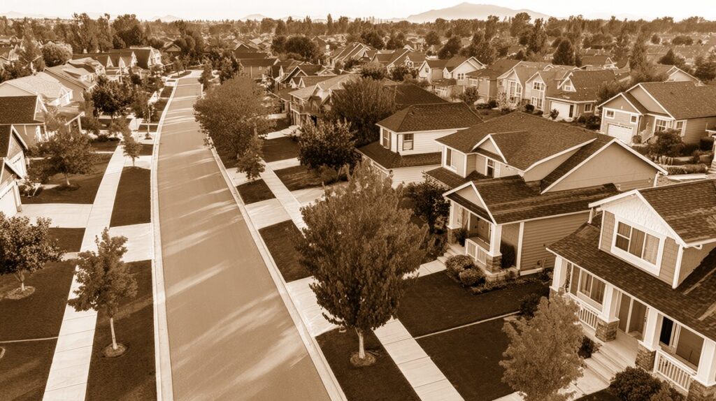
A Neighborhood Born in Arvada’s Suburban Era
Koldeway is one of those Arvada neighborhoods that can feel timeless at first glance. Its streets are quiet, its homes sit comfortably beneath mature trees, and neighbors often recognize one another from walks along the sidewalks or drives to nearby schools and shopping areas. Yet Koldeway is not an old farming settlement in the traditional sense. Its story begins in the postwar years, when Arvada was changing from a small agricultural community into a growing suburban city.
The neighborhood was established during the remarkable residential expansion of the 1950s. Across the Denver metropolitan area, returning veterans, young families, and new industries created demand for affordable single-family homes. Arvada, with its open land, mountain views, and convenient connection to Denver, became an attractive place to build.
Koldeway emerged as part of that larger transformation. The subdivision lies generally between Garrison Street and Independence Street, extending from Brooks Drive north toward West 62nd Avenue. It was bordered by the Alta Vista and Arvada West subdivisions, creating a broad mid-century residential landscape of ranch houses, practical floor plans, front lawns, and generously spaced lots. ([rosap.ntl.bts.gov](https://rosap.ntl.bts.gov/view/dot/22497/dot_22497_DS1.pdf?utm_source=openai))
How Koldeway Got Its Name
Unlike many Colorado neighborhoods named for natural features, patriotic themes, or nearby roads, Koldeway carries the surname of the people who created it. Henry J. and Eva Koldeway platted the subdivision, giving their family name to the new community.
The original Koldeway development was completed through three separate filings:
- The first filing was recorded in 1955.
- The Second Filing followed in 1957.
- The Third Filing was completed in 1959.
This staged approach was common in the postwar building boom. Rather than constructing an entire neighborhood at once, developers extended streets and utilities in sections as lots were sold and new families arrived. The result was a neighborhood that grew steadily over several years, with homes reflecting the popular building styles and expectations of the 1950s and early 1960s. ([rosap.ntl.bts.gov](https://rosap.ntl.bts.gov/view/dot/22497/dot_22497_DS1.pdf?utm_source=openai))
The name “Koldeway” therefore preserves a small but meaningful piece of local history. Every time residents give directions using Koldeway as a reference point, they are repeating the name of the family whose planning helped shape this part of Arvada.
Streets Designed for Everyday Life
One of Koldeway’s defining features is its straightforward street pattern. The subdivision was laid out with long, rectangular blocks divided into lots measuring approximately 68 by 106 feet. That arrangement offered enough room for a detached house, driveway, lawn, garden, and backyard—features that appealed strongly to families seeking more space than they could find in older urban neighborhoods.
Streets such as Brooks Drive, Garrison Street, Independence Street, and the connecting residential roads reflect the practical planning of the period. The neighborhood was designed primarily for living rather than commercial activity. Children could play in yards and on sidewalks, adults could work in Denver or nearby industrial districts, and families could reach shopping, schools, and civic facilities by car.
This pattern also helps explain why Koldeway has retained its residential character. There are no large commercial strips defining the neighborhood’s identity. Instead, its sense of place comes from the rhythm of its blocks, the consistency of its homes, and the gradual changes made by generations of residents.
Koldeway and the Growth of Arvada
Koldeway’s construction coincided with one of the most important periods in Arvada’s history. The city’s population and boundaries expanded rapidly after World War II as suburban development moved west from Denver. Nearby subdivisions, including Alta Vista and Arvada West, were built during the same general period, creating a connected network of postwar neighborhoods.
The opening of Interstate 70 between Wadsworth Boulevard and Kipling Street on January 28, 1967, further strengthened Arvada’s appeal. The highway made commuting easier and helped draw additional residents to communities west of Denver. Arvada’s population reached nearly 50,000 by 1970, a dramatic increase that reflected the broader suburban growth of the region. ([maps.arvada.org](https://maps.arvada.org/Attachments/HistoricProperty/SurveyReport.pdf?utm_source=openai))
For Koldeway residents, this growth brought both convenience and change. A neighborhood that may initially have felt somewhat removed from Denver became part of a larger metropolitan area. New schools, churches, stores, roads, and public services followed. Families who had moved into Koldeway during the 1950s and 1960s watched fields and open parcels disappear as Arvada filled in around them.
Nearby Landmarks and Community Anchors
Koldeway does not contain a single landmark building that defines its history in the way Olde Town Arvada does. Its heritage is more residential and collective. The houses, street trees, sidewalks, and familiar corners together form the neighborhood’s historic landscape.
Still, Koldeway sits within easy reach of several important Arvada institutions and landmarks. Olde Town Arvada, the city’s historic center, preserves early commercial buildings and civic sites associated with Arvada’s nineteenth- and early twentieth-century development. Its historic district is generally bounded by Ralston Road, Teller Road, Grandview Avenue, and Yukon Street. ([en.wikipedia.org](https://en.wikipedia.org/wiki/Olde_Town_Arvada?utm_source=openai))
The area also benefits from Arvada’s extensive park and trail system. Today, the city maintains more than 100 park sites and approximately 150 miles of trails across thousands of acres. Nearby parks, recreation facilities, and connecting routes give Koldeway residents access to the outdoor spaces that have become central to modern Arvada life. ([arvadaco.gov](https://www.arvadaco.gov/1039/Park-Inventory-and-Amenities?utm_source=openai))
Schools have also been important neighborhood anchors. The former Arvada school site on Balsam Street reflects the evolution of local education, while later school facilities served the growing families of postwar neighborhoods. The movement of schools and attendance boundaries over the decades mirrors Arvada’s continued population growth and changing community needs. ([resources.finalsite.net](https://resources.finalsite.net/images/v1710940928/jeffcopublicschoolsorg/e6ksvcn3hc7somye6eeb/arvada-k-8-boundary.pdf?utm_source=openai))
How Koldeway Has Evolved
The biggest change in Koldeway has not been a dramatic redevelopment, but the natural aging and renewal of a mature neighborhood. Original homeowners have passed houses to their children, sold to new families, or made way for younger residents. Ranch-style homes have gained additions, remodeled kitchens, updated landscaping, and energy-efficient improvements.
Mature trees now give the neighborhood a character that would not have existed when the first houses were built. Lawns have become gardens, patios, play areas, and outdoor gathering spaces. Some properties have seen careful renovations, while others retain the modest details and proportions of their original construction.
The neighborhood has also become more connected to the wider Arvada community. Residents can reach Olde Town, regional trails, shopping along Wadsworth Boulevard, and civic destinations throughout the city. What began as a stand-alone postwar subdivision is now part of an established urban fabric.
The Enduring Spirit of Koldeway
Koldeway’s special quality lies in its everyday history. It is a neighborhood shaped not by one famous event, but by decades of ordinary life: children walking to school, families tending gardens, neighbors greeting one another from front porches, and homeowners caring for houses first built more than half a century ago.
Its name recalls Henry and Eva Koldeway. Its streets preserve the planning ideals of mid-century Arvada. Its mature homes and trees tell the story of families who invested in the community and stayed long enough to give it a lived-in warmth.
For longtime residents, Koldeway is more than a subdivision on a map. It is a familiar collection of streets where Arvada’s agricultural past, postwar growth, and present-day community life meet—quietly, comfortably, and in a distinctly local way.